Document Underground Risks Before Construction Begins
Subsurface Utility Engineering (SUE) in Grand Junction for projects requiring verified utility data during design and pre-construction planning
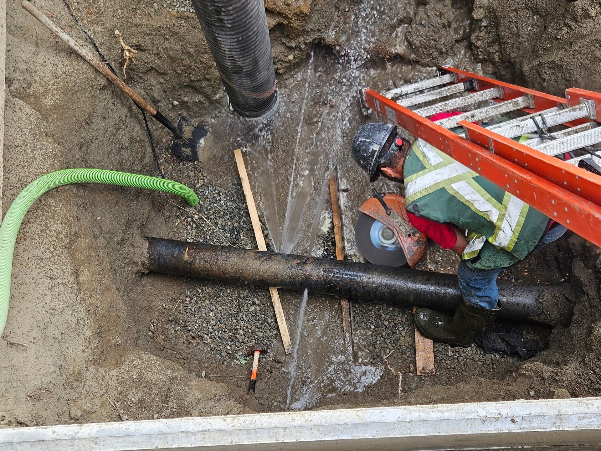
Engineering decisions made during project design depend on accurate information about what already exists underground, but outdated utility records and undocumented infrastructure create conflicts that appear only after construction starts. Subsurface Utility Engineering integrates records research, field locating, verification excavation, and geospatial documentation into a single process that delivers quality-level utility information to civil engineers, surveyors, architects, and planners. Rough Country Locates LLC provides SUE services in Grand Junction for infrastructure projects where utility conflicts, redesign costs, and construction delays stem from uncertainty about underground conditions that should have been resolved before plans were finalized.
SUE combines historical record analysis with field verification to establish where utilities actually run, rather than where decades-old maps suggest they should be. The process identifies conflicts between proposed construction and existing infrastructure early enough to redesign around them, avoiding the costly change orders and schedule disruptions that occur when utility discoveries force mid-construction plan revisions.
Incorporate SUE early in the planning process to improve project coordination and reduce unforeseen utility conflicts during construction phases.
What Quality Utility Information Changes in Project Outcomes
SUE establishes utility positions with measured accuracy rather than approximate locations based on as-built drawings that may not reflect post-construction modifications, abandoned lines, or undocumented installations. Verified utility data allows designers to route new infrastructure through zones where conflicts are minimal, adjust grading plans to maintain clearance from existing lines, and schedule utility relocations before excavation contracts are awarded.
Rough Country Locates LLC delivers SUE data in formats that integrate directly into engineering plans, providing horizontal and vertical utility positions that match the coordinate systems designers use for site layouts. Project teams reference this information throughout design development and construction, reducing the discovery of utilities that halt work while crews wait for revised plans or emergency relocations.
SUE addresses both new construction projects where utility conflicts affect site feasibility and infrastructure rehabilitation work where aging systems occupy space needed for modern replacements. The process does not eliminate all underground surprises, but it provides decision-makers with data accurate enough to avoid the most common and costly utility-related disruptions that derail project schedules and budgets.
Answers to Planning Questions
Infrastructure development across Grand Junction and Eastern Utah benefits from SUE when project complexity or site history suggests that existing utility records may not reflect current underground conditions.
What is the difference between SUE and standard utility locating services?
SUE integrates records research, field verification, and engineering documentation into a comprehensive process that delivers measured utility positions, while standard locating provides surface markings for immediate excavation needs without creating permanent records.
When should SUE be performed during the project timeline?
SUE should occur during preliminary design phases when utility conflicts can still influence site layouts, grading plans, and infrastructure routing without triggering redesign costs or construction delays.
How does SUE reduce project costs beyond avoiding utility strikes?
SUE eliminates redesign expenses caused by utility conflicts discovered mid-construction, reduces contingency budget allocations for unknown underground conditions, and prevents schedule delays that extend overhead costs and push completion dates into less favorable weather windows.
What quality levels does SUE provide and which level is appropriate for different project types?
SUE quality levels range from records research to field-located horizontal positions to vacuum-verified three-dimensional utility mapping, with level selection based on project complexity, utility congestion, and the consequences of utility conflicts during construction.
Why is SUE particularly valuable for municipal infrastructure projects in Grand Junction?
Municipal projects often involve roadways and utility corridors installed decades ago with incomplete records, making SUE essential for identifying conflicts before excavation begins in rights-of-way where multiple agencies share underground space.
Rough Country Locates LLC supports developers, municipalities, contractors, and infrastructure planners with SUE services that reduce utility-related project risks. Reach out to discuss how Subsurface Utility Engineering can improve outcomes for your next infrastructure project in the Grand Junction area.