Create Permanent Records of Underground Utility Positions
GPS As-Built Mapping in Grand Junction for organizations managing underground assets and planning future infrastructure expansions
Underground utilities installed today become the hidden obstacles that complicate future projects unless their positions are documented with precision that remains accessible long after construction crews leave the site. GPS As-Built Mapping collects horizontal and vertical utility position data using geospatial technology during locating or installation activities, creating digital records that facility managers, municipalities, and property owners reference decades later when excavation projects require accurate information about what lies beneath parking lots, roadways, and landscaped areas. Rough Country Locates LLC provides as-built mapping across Grand Junction for new installations and existing infrastructure where permanent documentation prevents the utility conflicts and exploratory digging that result from relying on outdated or nonexistent utility records.
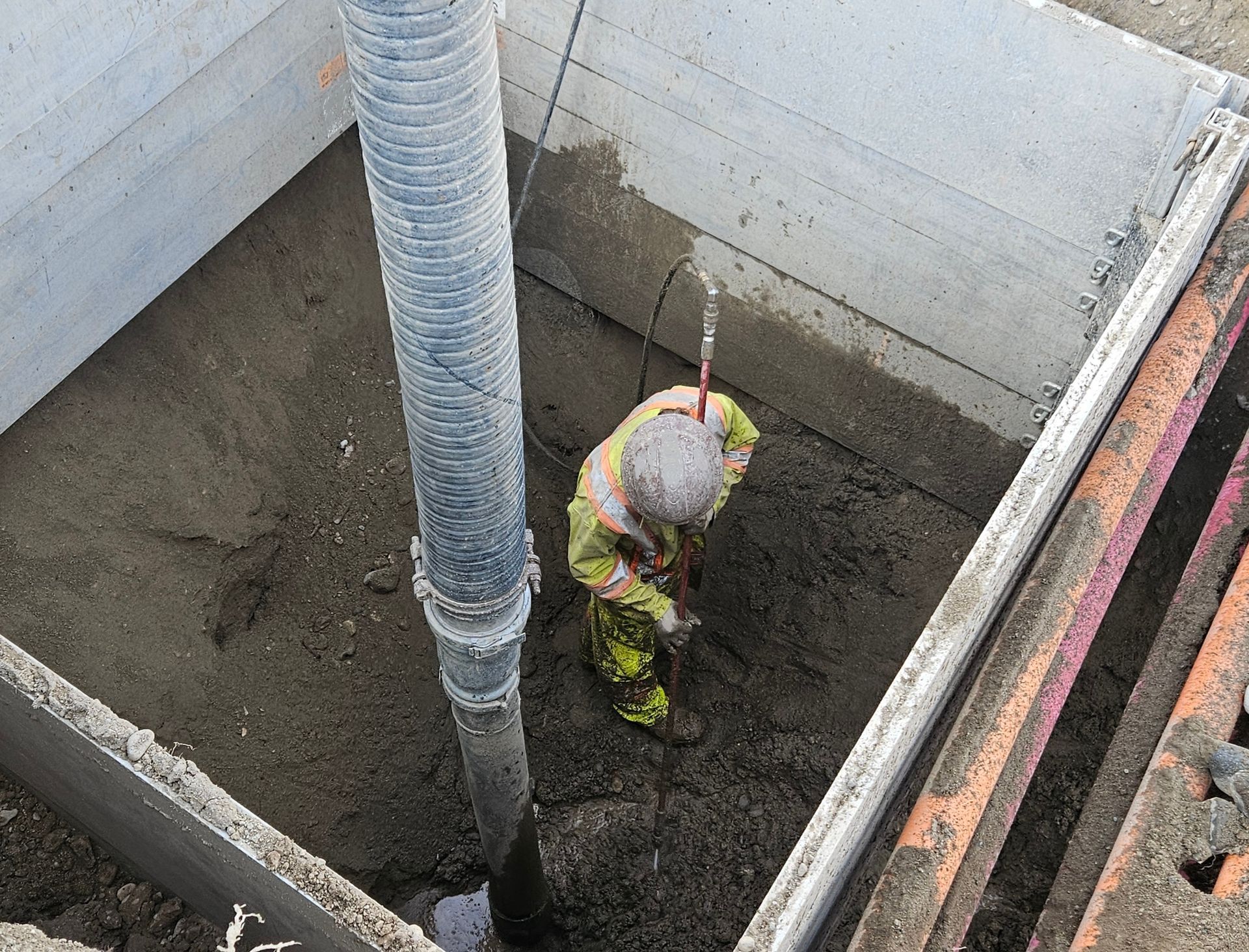
Mapping technicians use GPS receivers to capture precise coordinates of buried utilities during field verification or installation phases, recording depth, alignment, and infrastructure type in formats compatible with geographic information systems and computer-aided design software. The process transforms temporary surface markings into permanent digital assets that remain available for asset management, maintenance planning, and future construction coordination.
Request utility mapping services to establish reliable documentation of underground infrastructure and eliminate uncertainty during future excavation planning.
How Geospatial Documentation Supports Long-Term Asset Management
As-built mapping records utility positions at the time of installation or verification, capturing data while infrastructure is exposed or freshly located rather than attempting to reconstruct layouts years later when institutional knowledge has faded and site conditions have changed. Accurate maps reduce the need for exploratory excavation every time a project intersects existing utility corridors, allowing planners to route new infrastructure around documented lines rather than discovering conflicts during construction.
Once mapping is complete, facility managers and engineers access digital records showing where water lines cross beneath foundations, where electrical conduits run parallel to roadways, and where communication cables occupy trenches shared with other utilities. These records support maintenance decisions, guide infrastructure expansions, and provide the baseline data necessary for subsurface utility engineering on future projects within the same property boundaries.
GPS as-built mapping is particularly valuable for commercial developments, municipal infrastructure systems, and industrial facilities where utility networks grow incrementally over time and where incomplete records create risk during renovation or expansion projects. Mapping does not prevent all utility conflicts, but it establishes documented reference points that reduce the frequency of surprises when excavation encounters infrastructure that should have been identified during planning.
Frequent Mapping and Documentation Questions
Property owners and facility managers in Western Colorado increasingly recognize that as-built documentation reduces long-term costs by eliminating repeated locating expenses and preventing utility damage during future work.
What information does GPS as-built mapping capture beyond utility location?
As-built mapping records horizontal coordinates, depth below surface, utility type and material, installation date, and connections to other infrastructure, creating a comprehensive record rather than just a line on a map.
How accurate is GPS mapping for underground utilities?
GPS as-built mapping typically provides horizontal accuracy within inches and vertical accuracy sufficient for planning purposes, with precision depending on equipment quality and site conditions affecting satellite signal reception.
When should as-built mapping be performed relative to utility installation?
Mapping should occur while utilities are exposed during installation or immediately after vacuum excavation verifies their position, capturing data before trenches are backfilled and surface references disappear.
Why do municipalities benefit from comprehensive utility mapping programs?
Municipalities manage infrastructure installed over decades by multiple contractors, making centralized as-built records essential for coordinating future projects, avoiding utility strikes, and responding to emergencies when utility shutoffs require accurate location information.
How does as-built mapping integrate with existing facility management systems?
Mapping data exports to GIS platforms, CAD software, and asset management databases in standard file formats, allowing organizations to incorporate utility records into broader infrastructure documentation and maintenance planning systems used across Grand Junction and Eastern Utah.
Rough Country Locates LLC delivers GPS as-built mapping for developers, contractors, municipalities, and facility owners seeking reliable utility documentation that supports asset management and future infrastructure planning. Schedule mapping services to create permanent records of underground utilities on your property or within your service area.